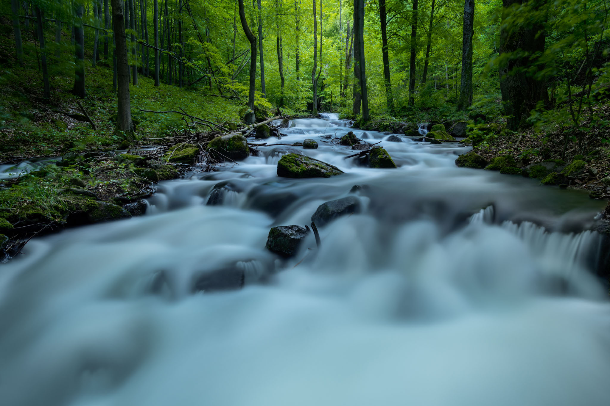
Veľká skala National Nature Reserve
The Veľká skala national nature reserve is located in the cadastral territory of our village. It is in the administration of the state nature protection of Ponitrie. The territory was declared protected in 1984 on an area of 59.2 ha. It is a nature reserve with the 5th level of protection, which forms part of the Bystričianská valley. The volcanic andesite bedrock is ideal for deciduous trees that have been here for years. Part of the Great Rock is not only its specific rock wall, best recognizable from Hrádek, but also the rock formation of the Twelve Virgins, or the Nine Virgins, or the Twelve Apostles. They are all names for the same tower-like rock formation peeking out from the nature reserve. Due to the instability of the andesite subsoil, mining is impossible here, and therefore the forest retains its original primeval beauty.
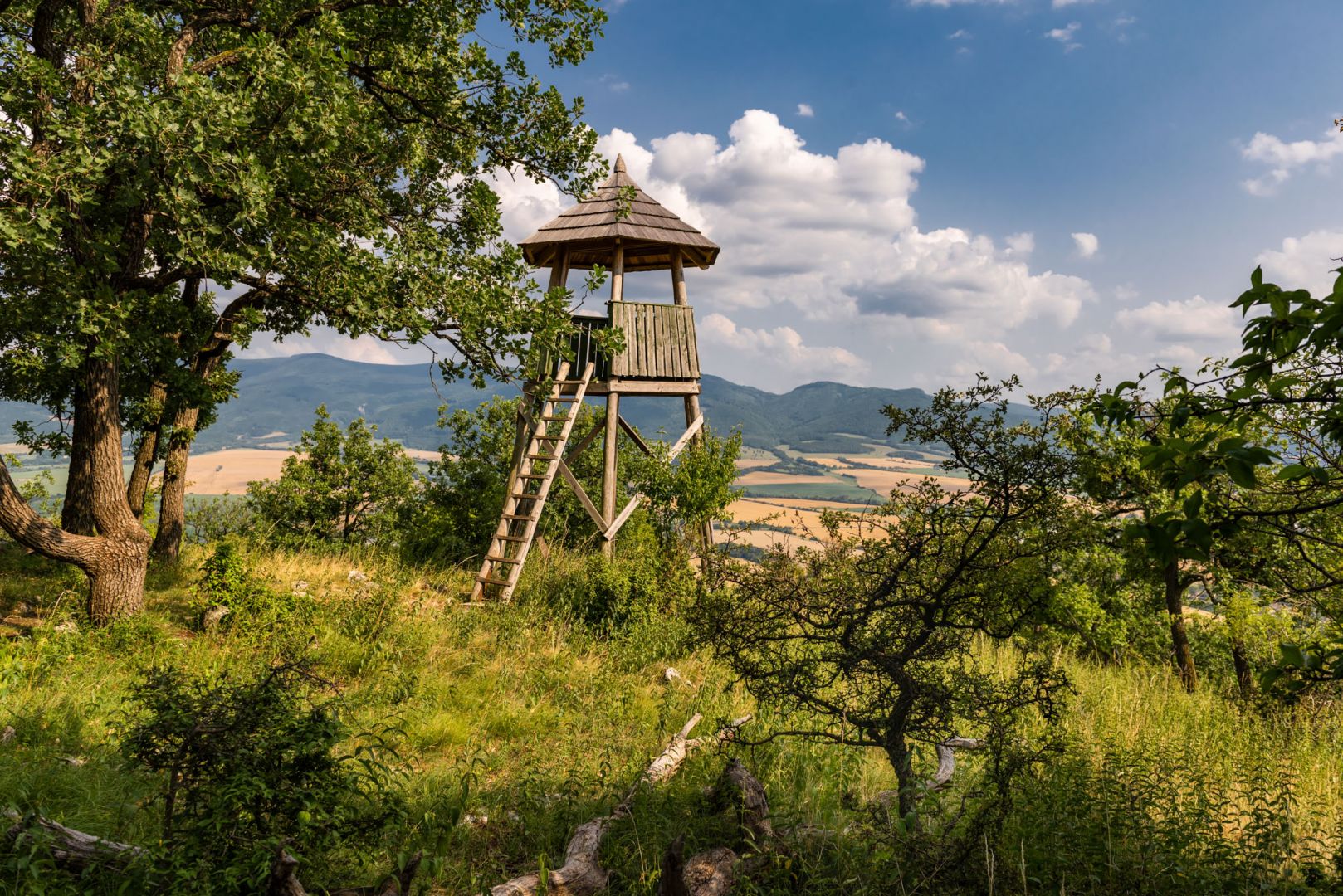
View of Malý Lubín
Malý Lubín is a very nice vantage point in the southeastern corner of the Strážovské vrchy, on the slopes of Drieňové vrch. A few years ago, they built a smaller lookout tower here, from which the visitor can see the Hornonitrian basin as if in the palm of his hand, and further in the background the Vtáčnik and Tríbeč mountains. Malý Lubín is a real pearl of the entire mountain range, and the views from it are among the most beautiful that the Drieňov mountain complex has to offer. From the parking lot near the area of the Chalmová Thermal Swimming Pool, the Chalmová Forestry Trail leads to Malý Lubín. Along the way, you will come across the wooden chapel of St. Hubert. More able-bodied tourists can continue their journey and climb Veľký Lubín.
Bystričian circuit
The 17.5-kilometer circuit will show visitors several important places - the Chalmová thermal swimming pool, municipal sports fields, natural beauty at the foot of the Vtáčnik mountain range, the airport, Farma pod Vtáčnik with excellent home-made specialties, etc. You will also find six boards on the route, from which you will learn interesting information. The circuit starts in front of the Chalmová thermal swimming pool gate. It is suitable for all age generations and you can complete it on foot or by bike.
Trasa okruhu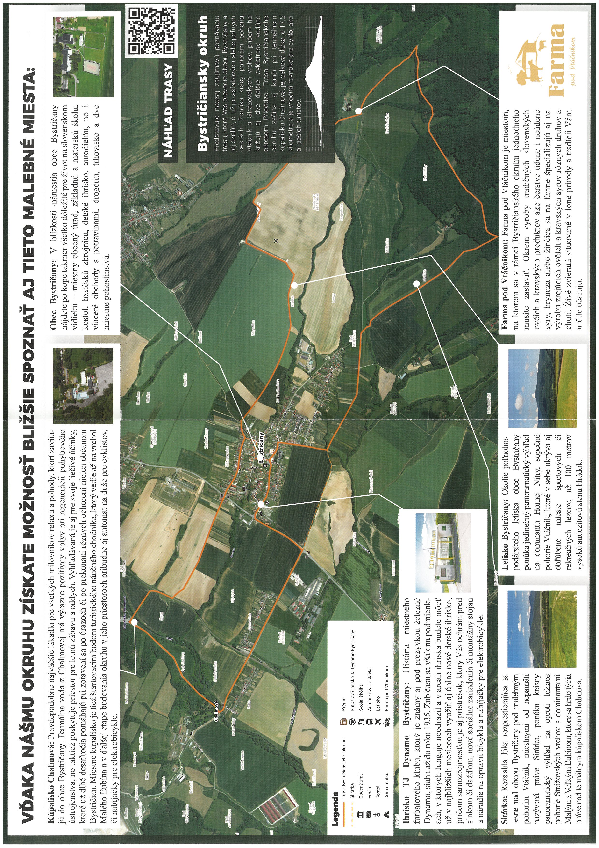
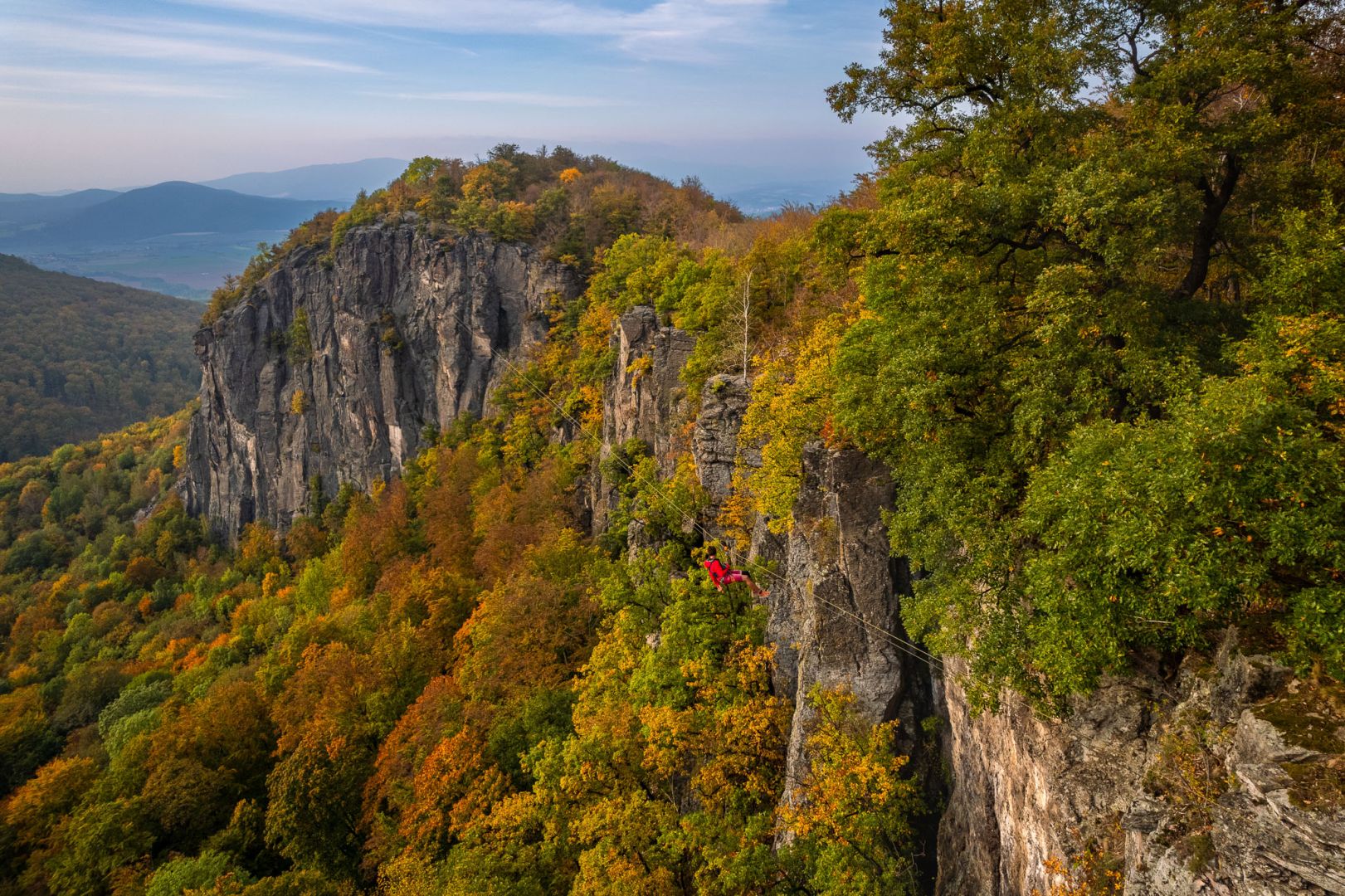
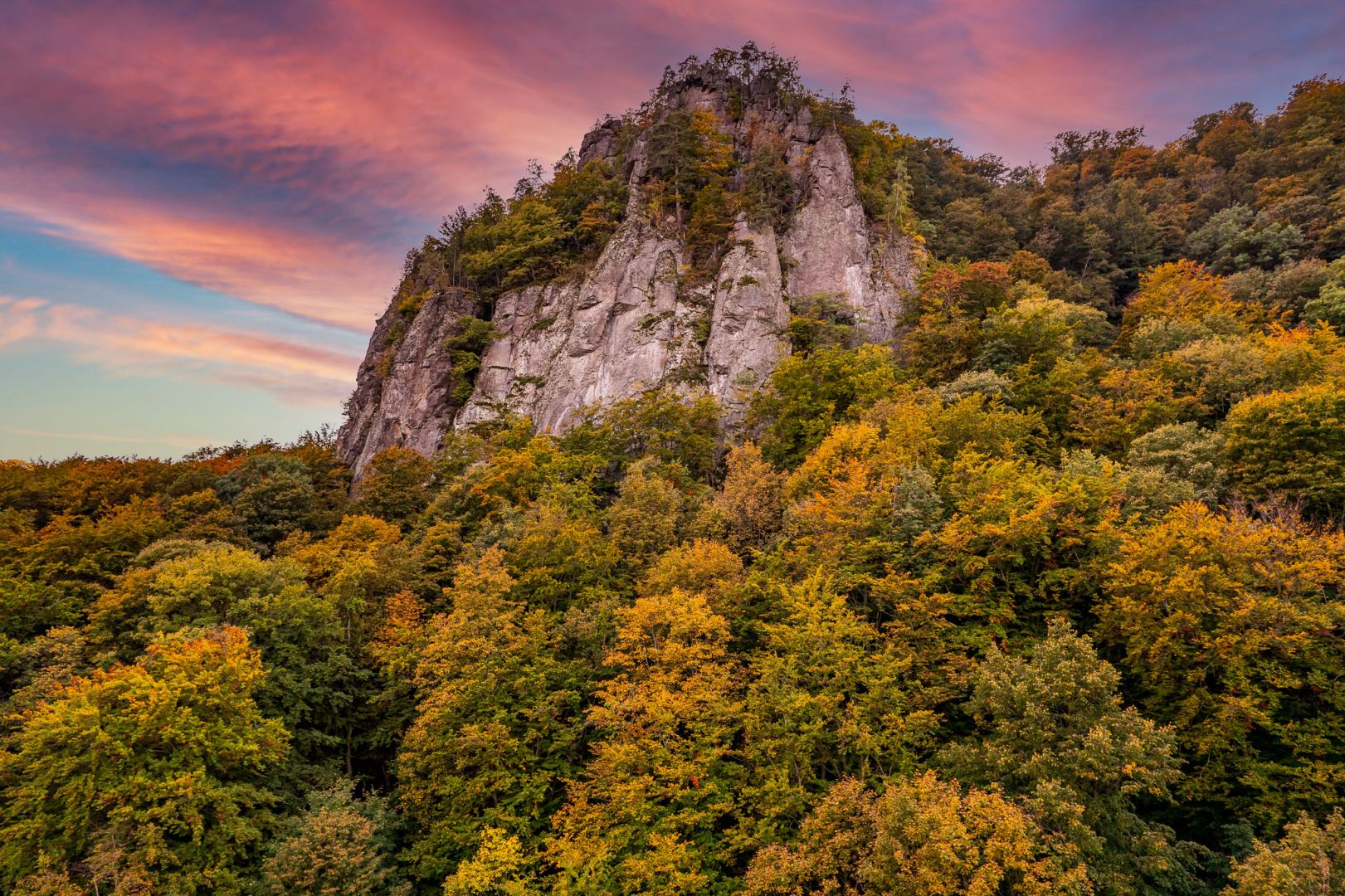
Hrádok climbing wall
Hrádok is the highest andesite wall in Slovakia and the second largest climbing area in the country after the Tatras. Climbing to the top of the rock formation, on which a pagan citadel spread centuries ago, climbers have more than 80 routes with different levels of difficulty at their disposal. After reaching the highest point of the massive wall, they will have a view of the beautiful Bystričianska valley. The Bystričianska valley is one of the most beautiful in the Vtáčnik Mountains and in the wider area of the Upper Nitra mining region. The climbing location of Hrádok is exceptional precisely because of its diverse range of difficult climbing routes in combination with the diversity of the beauty of the surrounding nature. Among other things, it belongs to the Ponitrie Protected Landscape Area and is also part of the Natura 2000 protected area.
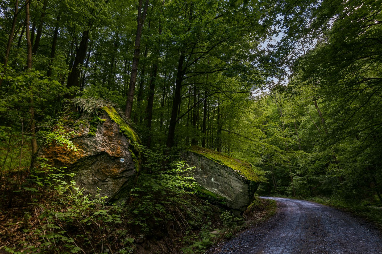
Chodník Petra Školna
In 1955, Peter Školna founded the Department of Tourism at TJ Dynamo Bystričany, which, in addition to tourist activities, was also dedicated to the marking of hiking trails on the upper Nitra. The second area in which this department dominated was orienteering. In 1962, he significantly participated in the organization of the Czechoslovakian Orienteering Championships. Blažej Kováč and Andrej Mikler won the title of Czech SSR champions in the category of older teenagers. Under the leadership of Peter Školna, 12 mark makers emerged from our village, most of whom are still making marks today. In 1959, 240 km of hiking trails were marked in our region, and in the following year, up to 264 km of hiking trails. One of them was the blue tourist route number 2604 Bystričany – Bystričianská dolina – Vtáčnik with a length of 14.2 km. Since 2003, it has been called Chodník Petra Školna.
Vtáčnik Mountains
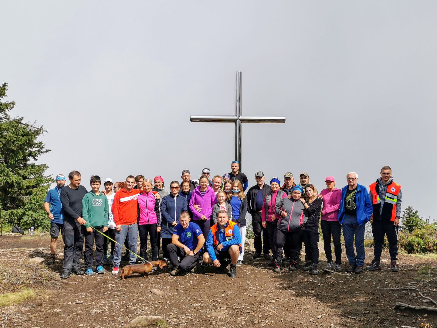
Vrch Vtáčnik is the highest point of the Trenčín region, it measures 1346 meters above sea level. It is located on the main ridge of the mountain range of the same name, which also leads the border between the Banskobystrica and Trenčín regions. You can reach it from the village of Bystričany by following the blue sign. The peak itself has recently been a sought-after location and several hiking trails lead here. A walk through the forest through narrow paths lined with blueberries is just a short way to the very top of Vtáčnik. At the top of the highest point of the Vtáčnik mountain range, there is a tall stainless steel cross that glistens in the sun's rays. Here you will have a wonderful view of the Hornonitrian Basin and the surrounding mountains. Every year in August, the village of Bystričany organizes the tourist event of climbing Vtáčnik, which it takes place in connection with the celebrations of the Slovak National Uprising. Every year, the ascent is attended not only by citizens of the village, but also by other tourist enthusiasts and nature lovers.
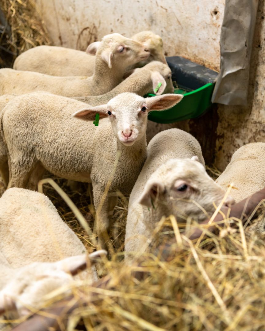
Farm under Vtáčnik
In the cadastral territory of the village of Bystričany there is a magical "Farm under Vtáčnikom". It got its name from the Vtáčnik mountain range, under which it extends. The farm is mainly focused on breeding sheep of the French Lacaune breed, but Limousine meat cows are also bred on the farm. Animals from the farm graze the surrounding meadows. In a beautiful environment surrounded by mountains and meadows, you can sit and enjoy draft beer, which goes perfectly with cheese products produced directly on the farm. For example, cheese boards with a neck are popular. Products are made here from fresh milk that has just been milked, e.g.: fresh sheep's cheese, smoked sheep's cheese, 100% sheep's bryndza, with which they have already scored points in many competitions, as well as ripening cheeses, which in 2022 won the best ripening cheese award at the AGrokomplex. The most popular product of the farm is cow thread, which is regularly visited by citizens from the surrounding area. A playground, archery and various games are available for children, and various experiential events are organized on the farm throughout the year, for example on the occasion of the opening of the sheep season. She had a great success this year as well. The farm is popular with hikers and cyclists who stop for refreshments, but the farm can also be reached by car through the village of Kamenec pod Vtáčnikom. Facebook.com
Geographical location of the village
Bystričany are located in the Prievidza district, which is the core of the upper Nitra region in the Trenčín self-governing region. The cadastre of the municipality with the territorial units of Bystričany, Chalmová and Vieska has a total area of 3763 ha. It is located in the southern tip of the Hornonitrian basin, on the southernmost spurs of the Strážovské vrchy and the western slopes of the Vtáčnik mountain range at an altitude of 255 m above sea level in the center of the village, with an elevation of around 1000 m in the countryside. The Nitra river flows through the area, gathering smaller tributaries flowing from the surrounding mountains, the most important of which is the Bystrica stream.